Aerial system helps predict ‘depth’ of Colorado’s largest reservoir

Predicting how much water will be available from the American West’s largest reservoir — the snowpack — has taken on new importance because of the changing climate. As a result, new technology enables the predictions to be more accurate, said Jeff Deems, cofounder of Airborne Snow Technologies.
THIS ARTICLE IS FOR SUBSCRIBERS ONLY
Continue reading for less than $3 per week!
Get a month of award-winning local business news, trends and insights
Access award-winning content today!
Related Posts
-
Woodward Inc. has signed an agreement to sell its heavy-duty gas turbines combustion parts business.
-
DMC Global CEO Michael Kuta is retiring amid a period of rough seas for the…
-
Xcel Energy Colorado has requested approval from the Colorado Public Utilities Commission to reduce customer…
-
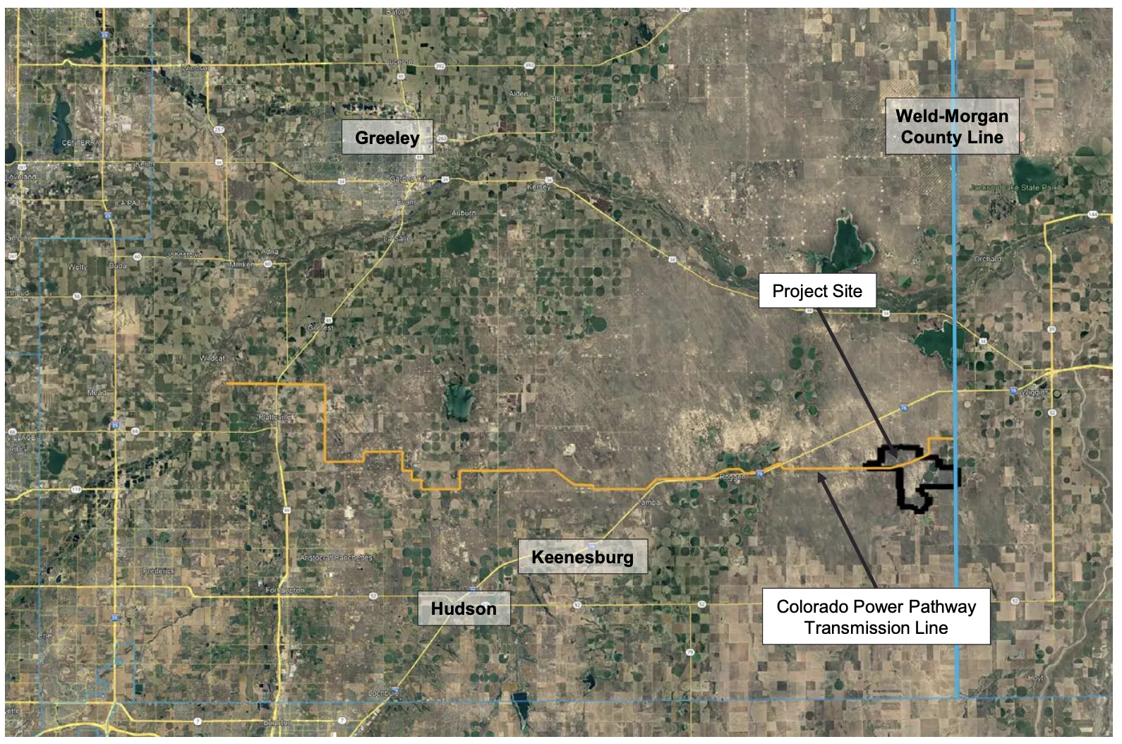
The Weld County Planning Commission on Tuesday will consider a 4,300-acre solar farm by feedlot…