Mapmaker Tabaian generates trail maps for outdoor enthusiasts
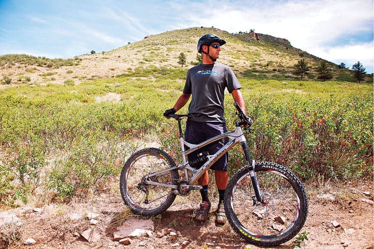
BOULDER — Making a wrong turn while traversing the trails of Colorado could turn a good day into a scary scramble.
But a fit-in-your-pocket trail map could keep you on track and moving straight ahead, relatively speaking.
Farid Tabaian launched Singletrack Maps in 2009 and to date has sold more than 30,000 copies to outdoor recreation enthusiasts looking for a way to navigate Colorado’s trail systems. The seven trails he’s mapped include Hartman Rocks in Gunnison and Durango trails, which include a tour through the towns.
SPONSORED CONTENT

Empowering communities
Rocky Mountain Health Plans (RMHP), part of the UnitedHealthcare family, has pledged its commitment to uplift these communities through substantial investments in organizations addressing the distinct needs of our communities.
What sets Singletrack Maps apart from the competition is the detail, Tabaian said.
“I focus on things like how trails link into roads and how trail alignment contours with hillsides,” he said. “We collect our own GPS data to get detailed trail alignment.”
He decides on what trails to map based on how they’ve been viewed in the past and how much attention they receive in the present.
“I choose areas that haven’t been done before and that are big destination spots like the Front Range, Crested Butte and Durango.
Tabaian claims his company is the first to make maps water resistant and small enough to fit into a cargo or jersey pocket.
Tabaian, sole owner with no employees, starts his mapping projects by using data collected by federal agencies and then adding detail. He rides the trails to rate them according to difficulty and then recommends directions for beginners, intermediate and advanced trail users.
The maps are designed to guide mountain bikers, hikers, equestrians and people driving motorized vehicles.
“My vision is to only sell the maps to locally owned stores because my personal belief is that money spent in local areas creates better communities,” Tabaian said. The maps are printed in Loveland, and he personally delivers all orders to retail outlets.
Sellers of his maps include bike shops, outdoor recreation stores, map stores and bookstores as well as online through Singletrack Maps website. Retail locations include Colorado, New Mexico and Utah.
Individual maps range from $11.99 to $12.99.
In addition to general area trail maps, Singletrack creates maps for bike and foot races and tours. Those events have included Ride the Rockies and Pedal the Plains.
“I’ve made maps of the whole routes that they could show when they announce the races and then have on their websites,” Tabaian said. “I work with them to make profiles of each day’s route and graphics of elevations they’ll climb and descend as well as the mileage.”
Cost to the race sponsors ranges from $50 to $2,000. The maps are provided free to racers.
Although trail maps are Singletrack’s primary business, the company also has created a wall map of Colorado, available only on its website and at Boulder Map Gallery, for $200.
“It’s for people who want a detailed road map or to see the area’s terrain,” Tabaian said. “I love to hear the stories when people stand in front of the map.”
Five percent of the company’s business focuses on T-Shirts that Tabaian designed and makes in Boulder. They cost $22.
Tabaian started Singletrack Maps with $5,000 personal funding. His background as a cartographer who grew up in Boulder and studied geography and cartography at the University of Colorado-Boulder led him to the interest in trail maps.
“I had a really good geography teacher in high school, and when I took some cartography and geography classes at CU, I was blown away with what could be done to make maps.”
Challenges to getting his business up and running include creating new maps as well as being a new kid on the block.
“Being a small company, the biggest challenge has been getting the product into stores and having the money to print more maps that cover different areas.
“Doing what I love to do, however, means that the challenges won’t stop me.”
BOULDER — Making a wrong turn while traversing the trails of Colorado could turn a good day into a scary scramble.
But a fit-in-your-pocket trail map could keep you on track and moving straight ahead, relatively speaking.
Farid Tabaian launched Singletrack Maps in 2009 and to date has sold more than 30,000 copies to outdoor recreation enthusiasts looking for a way to navigate Colorado’s trail systems. The seven trails he’s mapped include Hartman Rocks in Gunnison and Durango trails, which include a tour through the towns.
What sets Singletrack Maps apart from the competition is the detail, Tabaian said.
“I focus on things like…
THIS ARTICLE IS FOR SUBSCRIBERS ONLY
Continue reading for less than $3 per week!
Get a month of award-winning local business news, trends and insights
Access award-winning content today!