Wohnrade Civil Engineers get new LiDAR-equipped drone
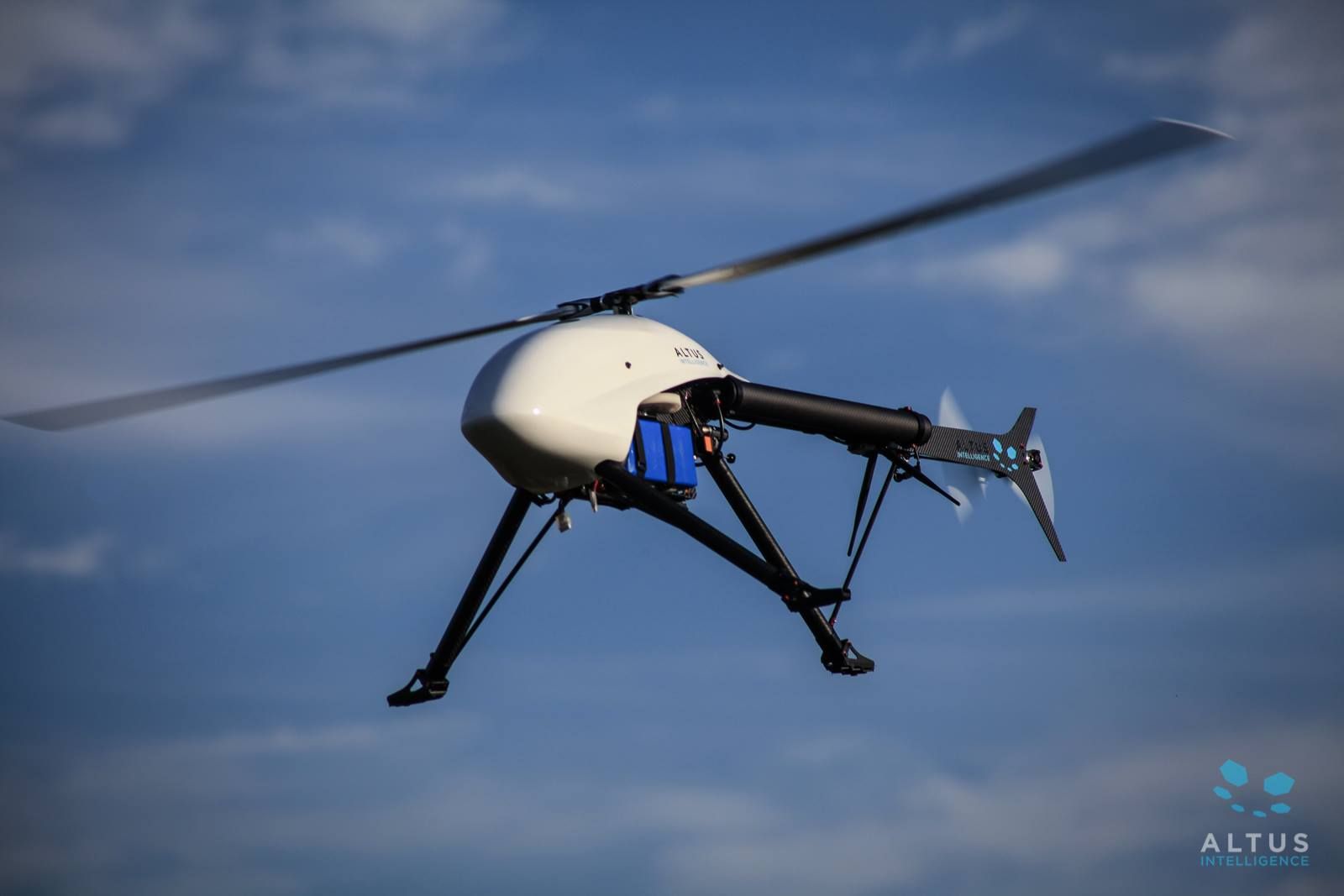
BROOMFIELD — Wohnrade Civil Engineers Inc., a full-service engineering firm that incorporates data obtained by unmanned aerial vehicles into civil engineering design, has added a new drone to its lineup.

The Altus ORC2 electric helicopter is equipped with an advanced topographic LiDAR, or Light Detection and Ranging, survey sensor. The technology produces three-dimensional laser scans that enable Wohnrade Civil Engineering to deliver highly accurate topographic survey maps, even when there is dense vegetation or mountains.
The addition of the new platform allows WCE to expand its UAV offerings to a broad range of clients.
SPONSORED CONTENT
How dispatchable resources enable the clean energy transition
Platte River must prepare for the retirement of 431 megawatts (MW) of dispatchable, coal-fired generation by the end of the decade and address more frequent extreme weather events that can bring dark calms (periods when there is no sun or wind).
“We have been committed to delivering the most accurate data possible using the latest advances in UAV technology since purchasing our first drone in 2015,” Mary Wohnrade, principal engineer of Wohnrade Civil Engineers, said in a prepared statement.“LiDAR allows us to further enhance the accuracy of our geospatial mapping products while saving our clients both time and money. We can quickly certify the data collected and incorporate that mapping into final civil engineering designs allowing developers to optimize their investments while progressing their projects forward effectively and efficiently.”
BROOMFIELD — Wohnrade Civil Engineers Inc., a full-service engineering firm that incorporates data obtained by unmanned aerial vehicles into civil engineering design, has added a new drone to its lineup.
The Altus ORC2 electric helicopter is equipped with an advanced topographic LiDAR, or Light Detection and Ranging, survey sensor. The technology produces three-dimensional laser scans that enable Wohnrade Civil Engineering to deliver highly accurate topographic survey maps, even when there…
THIS ARTICLE IS FOR SUBSCRIBERS ONLY
Continue reading for less than $3 per week!
Get a month of award-winning local business news, trends and insights
Access award-winning content today!